Pages

Showing posts with label Mayo. Show all posts

Monday, January 13, 2014

Cong

Fan of "The Quite Man" or not Cong is definitely worth a visit.

Cong, which is in south Mayo, was firmly placed on the tourist map thanks to John Ford's 1952 movie "The Quite Man". Starring John Wayne and Marureen O'Hara, much of the filming took place in and around Cong including on the grounds of Ashford Castle. There is of course the landmark feature of the movie Pat Cohan's pub in the village and the bridge where Bishop and Rev. Playfair view the fight is on the grounds of the Castle.
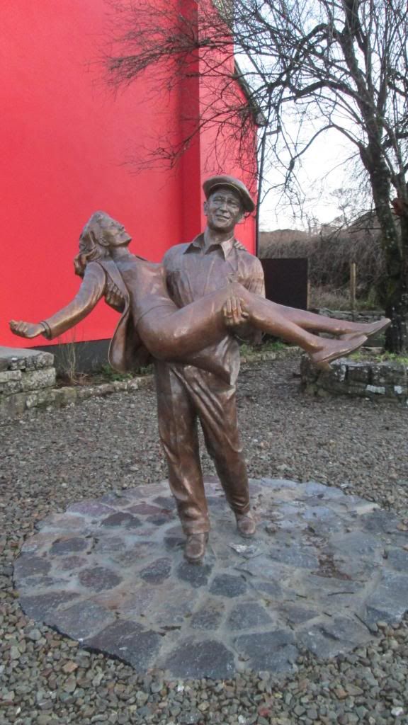
John and Maureen


Cong itself is quaint riverside village.  Pat Cohan's pub is still there right in the centre with frontage largely as its was for the movie. There is also a small museum in the Quiet Man Cottage but it is not the cottage in film. That lies in ruins just off the R336 between Maam Cross and Maam. Aside from its connections to the Quiet Man, Cong has much to offer. Ashford Castle is located just outside the village and the village itself has the magnificent ruins of Cong Abbey.

Cong Woods
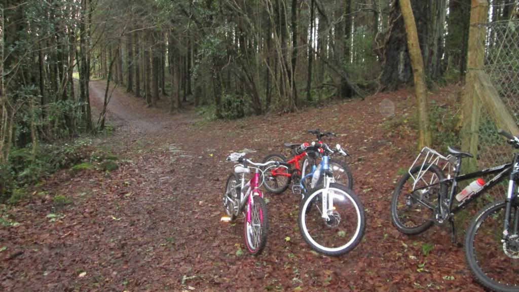
But the real magic of Cong, which most tourist miss, are the trails through the woods. From a Monk's fishing house to the Guinness tower to the Pigeon Hole and various caves and tombs there is so much to discover in Cong Woods. There are a number of tails (walking and cycling) throughout the Cong/Ashford/Clonbur woods. It is possible to walk or cycle from Cong to Clonbur entirely on forest roads. On your way back loop down through Ard na Gaoithe and the grounds of Ashford. It doesn't get the attention of the Great Western Greenway but in our opinion it easily rivals it for a day out.
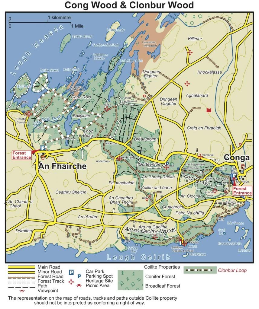
Trail Map


There is also a good MTB trail marked out in the woods that criss-crosses the main fire roads. It doesn't offer much by way of assent/descent but it is still well worth doing. If you have kids, it's a very good trail for introducing them to MTB. Cross the footbridge by the monks fishing house and the trail begins directly in front of you. Just watch out for walker and horses and give way.

There is also an interesting walk along the would be but failed Mask to Corrib canal. The canal was built to link the large lakes of Mask and Cong. However, on completion the water all leaked away do to the limestone base thus dooming the canal. The entrance to the canal walk, pictured below, is beside the large car park. Just follow the grass path. Just ahead you will see the remaining structure for one of the canal locks. A little further out the road you will see an entrance to the walk for Kelly's cave.
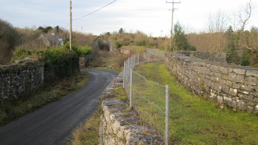
Cong Canal


Lough Corrib
Another gem of Cong is the access to Lough Corrib and Inchagoill Island. Corrib Cruises, which is owned and operated by the Luskin brothers, run a very good cruise to and tour of Inchagoill Island. Inchagoill has the remains of an early Christian settlement and one of the Luskin brothers usually leads a short tour providing a history of the ruins. On some of their schedules, it's also possible to continue on to continue across the lake to Oughterard.

Lough Corrib is also renowned for fishing and boats and gullies are available to hire locally. Enquire in the tourist office. You should also check out the photos of the record trout caught on Lough Corrib by Ceri Jones in 2012 in the window of Burke's pub in Clonbur. The fish itself is on display inside.


Parking and Campsite
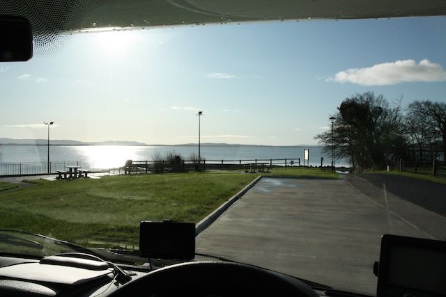
There is a large car park as you approach the village from the east. But, it does have a hight barrier. However, it is possible to get tokens to raise the barrier at the local filling station and Ryans Hotel. Note you will need two tokens. One to get in and one to get out. But be warned the barrier can be a bit temperamental and it has been known not to open! Overnight parking is not permitted here. There is a campsite a little further outside the town. If you don't want this hassle then you will need to find someplace else to park. There is little parking available in the village itself but if your van is small and you are very lucky then you might get a spot. You will find other spots near the village but I don't want to recommend a particular one.
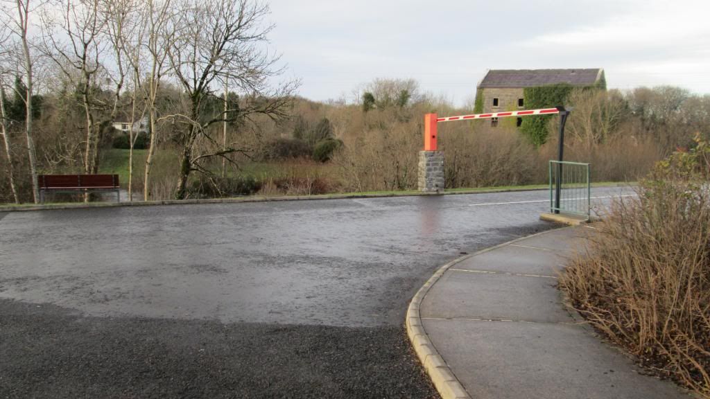


Work-in-progress

Wednesday, June 6, 2012

Mayo Costal Route North to South

Mayo Route 01 - Costal North to South. 
The route begins in Ballina Co. Mayo and ends in Leenane Co. Galway. 

Route overview: Ballina - (Crossmolina) - Killala - Ballycastle - Belmullet - Achill - Mulranny - Newport - Westport - Louisburgh - Leenane.

The route could be completed in 2-3 days or take a month if you so fancy after all that is one of the many beauties of a campervan vacation.

The north Mayo market town of Ballina is the suggested starting point for this route (end point if you choose to do it in reverse). Ballina is the principal town in north Mayo and has a good variety of shopping outlets and other services. A good spot to park up is by the river in front of the Cathedral. There is plenty of space and the location is central to the town. If you plan to stay in the area, there is a good campsite outside the town near Belleek woods. The woods themselves are on the banks of the river Moy and very pleasant  for waking and cycling. The river Moy is famous for its salmon and is the impetus to the annual festival held in the town each year. 

There is also an official Aire (you wont find many of these in Ireland) in the town of Crossmolina which is about 8 miles further west. Officially there are two campervan parking spaces. They are currently finishing the services block and the area is monitored by CCTV.

Crossmolina Aire

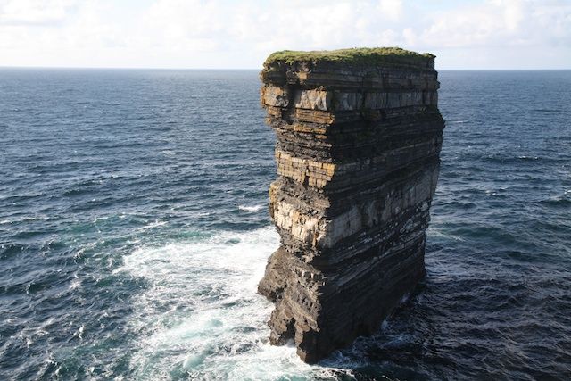
From here (Crossmolina or Ballina) proceed to Killala and onwards to Ballycastle. Near Ballycastle the Sea Stack at Downpatrick Head is well worth a visit and you can quite safely wild camp the night there. 

Down Partrick Head - DĂșn BristĂ©


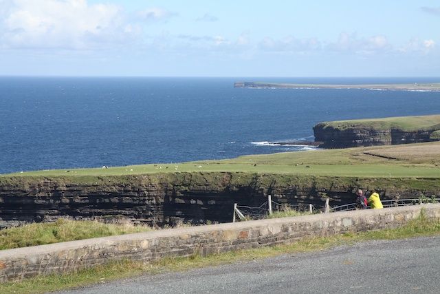
A little further up the road you can visit the Ceide Fields which is worth a stop for the view alone (assuming you hit it on a good day).

View from Ceide Fields


Proceed along the north Mayo coast to the Belmullet peninsula. However, if time permits you could consider taking in remote villages such as Porturlin and Portacloy. If the weather is good the it is well worth spending a day or two on the peninsula. There is a very pleasant walk called the Erris Head Loop and it is easy enough to find wild camping spots down near the beaches in the south of the peninsula.

Next continue on to Achill Island (one of our personal favorites) but it is also worth stopping at Ballycroy National Park en-route. If you are up for it you can spend the whole day walking through the wilderness of the National Park. Achill is wonderful and if you arrive in early June you will be treated to the wonderful Rhododendron blooms. Shortly after crossing the bridge to the island you will see signs for Atlantic drive. Be sure to do this atlantic drive and it is best driven from East to West.

Achill - Atlantic Drive


There is a beach side camping site at Keel and another on the North side of the Island. The drive back to Keem bay is spectacular on a fine day but you need to have a head for heights!


After Achill you should head towards one of the jewels of Mayo, the lovely town of Westport. Along the way you will be travelling beside the Great Western Greenway. Which is recently developed off road walking and cycling trail that goes all the way from Achill Sound to Westport. Check back later for a blog on the Greenway.

Westport is a lovely town with great food and entertainment establishments but it can be difficult to find parking for a camper. You will find a lot of campers parked up on the Quay, which is a bit outside the town, and many overnight here. There is also a good campsite attached to Westport House and there is a walking path to take you to town. Westport House itself is good with a fair range of activities but overall is more aided at families with kids. Couples traveling alone my not think it worth the entry fee.

Moving on from Westport you should head towards Louisburgh and if you are up for it climb some/all of Croke Patrick as you pass by. The drive from Louisburgh to Leenane along the R335 which runs past Doo Lough and through the Dephi valley is very picturesque and best experienced traveling North to South. Once you hit Leenane, on the easterly tip of the Killary Fjord, you will be in county Galway and will need to decided to go next. But check back later for our Galway posts for our suggestions.